From Metro Phoenix:
Take Grand Avenue (it runs North West) to Patton Road (approximately 5 miles north of Sun City Grand). Go west on Patton Road for about
13 miles. After you go down through the Hassayampa river basin and up on high ground watch for the intersection of 299th Avenue and Patton Road. This puts you at
the Southeast corner of Whispering Ranch.
From Wickenburg:
Take Highway 60 east to Vulture Mine Road. Go south on Vulture Mine Road approximately two miles past the Vulture Mine, you will come to another dirt road on the east
and a sign that says "Whispering Ranch Road" that heads east. This road will get you to Whispering Ranch at about 355th Avenue and Whispering Ranch Road. From this entrance,
you can go east on Whispering Ranch Road and then north on 347th Avenue until you get to Carefree Highway. (Click on and print Whispering Ranch maps -east and west -
prior to heading out there).
Here are a few helpful hints to reading the map and finding your way around. Whispering Ranch is laid out in one-mile grids. Each of these grids is divided into 128 five-acre parcels. Getting to the individual parcels can be a bit of a challenge since you will be on dirt roads with very few road names. The addresses of the properties follow these logical rules. If a street runs from east to west, the odd numbered addresses are on the south side of the street and the even numbered addresses are on the north side of the street. For the roads that run from north to south, the odd numbered addresses are on the east side of the road and the even numbered addresses are on the west side of the road. Let's say you are looking for 33498 W. Painted Wagon. First thing to do is get to the nearest intersection - that would be 331st Avenue and Painted Wagon. Once there, you would head west and watch for a sign on the north side of the road. Pretty simple, huh?
The north/south roads are marked on the maps and on the intersection markers as E-1, "0", W-1, W-3, etc. These roads are one mile apart and run parallel to
each other. There are no other major roads running north and south. The major east/west dividing road is 307th Avenue. Everything east of 307th Avenue has an
"E" designation, and everything west has a "W" designation.
The east/west roads are named, but they also have number indicators. Looking at the map, you'll see that Painted Wagon Trail is ("0") and is the north/south dividing road. Everything north from here has an "N" designation and everything south an "S" designation. The east/west streets are 1/4 mile apart, and every parcel out here fronts on one of these roads.
To get your bearings, look at the north-east corner of major road intersections and you will see a small post with two metal plates. The plates indicate the intersection of two roads, North or South by East or West. And on my map, each of the roads that run east/west and north/south have a letter and number in parentheses after the road name. These correspond to the letters and numbers on the little marker posts on the intersections. If you are at "S-6, W-1" you can find these roads on the map to determine you are at Lone Mountain and 315th Avenue. Or, if you should find yourself at a junction of two roads and the little sign says "N-2, E-1", a little figuring on the map will tell you're at the intersection of 299th Avenue and Carefree Highway. The major roadways are on this map with the north-south/east-west indicators in parentheses after the road names. Some of the intersections are missing these markers . Don't panic . . . just drive north or south or east or west until you find a marker, then figure out where you are and head out again.
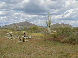
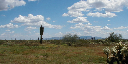
Now don't get too confident yet . . . there are a lot of roads that look like they go through but they really don't because of some geographical event - like over the years the roads have washed out and nobody fixed them. And remember that some of the roads have not been used since they were cut in by a bulldozer back in the early 1960's. There are washes, arroyos, floodway areas, ravines, mountains, and lot of roads that are difficult to traverse. Keep your eyes open for those little marker posts and the E/W notations along with the N/S notations. If you need to wander around a little to get your bearings, that's OK. Just enjoy the scenery - it is really spectacular in a lots of different areas, and worth taking the time to view. Your best bet (if you decide to venture out here) is at least a high profile vehicle, and preferrably a Four Wheel Drive. I would "not" recommend using a passenger vehicle to get around out there. And if you are afraid to get your vehicle dirty or risk Arizona Pinstriping, have a friend drive out. Recommended items would be some bottled water, a flare gun, snakebite kit, cell phone, GPS and a sense of adventure. A sense of humor helps at times, too.
Copyright 2004-2026, J. D. Liberty